
Fisye:Antananarivo01.jpg

Size of this preview: 800 × 545 pixels. Other resolutions: 320 × 218 pixels | 640 × 436 pixels | 1,024 × 698 pixels | 1,280 × 872 pixels | 2,402 × 1,637 pixels.
Original file (2,402 × 1,637 pixels, file size: 1.29 MB, MIME type: image/jpeg)
Summary
| Description |
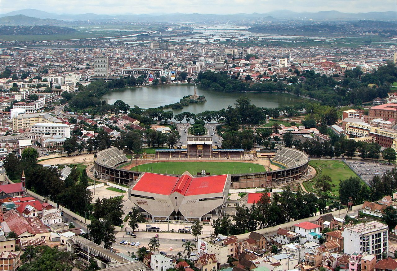
Français : Antananarivo - stade municipal de Mahamasima et lac Anosy, Madagascar English: Antananarivo - Mahamasima Stadium and Anosy lake, Madagascar |
| Date | |
| Source | Own work |
| Author | Bernard Gagnon |
| Camera location | | View this and other nearby images on: OpenStreetMap |
|---|
Baluve
I, the copyright holder of this work, hereby publish it under the following licenses:

|
Permission is granted to copy, distribute and/or modify this document under the terms of the GNU Free Documentation License, Version 1.2 or any later version published by the Free Software Foundation; with no Invariant Sections, no Front-Cover Texts, and no Back-Cover Texts. A copy of the license is included in the section entitled GNU Free Documentation License. |
This file is licensed under the Creative Commons Attribution-Share Alike 3.0 Unported, 2.5 Generic, 2.0 Generic and 1.0 Generic license.
- You are free:
- to share – to copy, distribute and transmit the work
- to remix – to adapt the work
- Under the following conditions:
- attribution – You must give appropriate credit, provide a link to the license, and indicate if changes were made. You may do so in any reasonable manner, but not in any way that suggests the licensor endorses you or your use.
- share alike – If you remix, transform, or build upon the material, you must distribute your contributions under the same or compatible license as the original.
You may select the license of your choice.
File history
Click on a date/time to view the file as it appeared at that time.
| Kilumbu/Ngûnga | Thumbnail | Dimensions | Sadi | Comment | |
|---|---|---|---|---|---|
| bubu yayi | 22:56, 9 ngônda ya zôle 2011 | | 2,402 × 1,637 (1.29 MB) | Bgag | tilt corrected |
| 21:50, 19 ngônda ya sambânu 2008 |  | 2,587 × 1,727 (781 KB) | Bgag | {{Information |Description={{fr|Tananarive - stade municipal de Mahamasima et lac Anosy}}{{en|Antananarivo - Mahamasima Stadium and Anosy lake}} |Source=travail personnel |Date=2007-02-19 |Author=Bernard Gagnon |Permission=see below |other_ | |
| 04:22, 3 ngônda ya tatu 2008 |  | 2,592 × 1,944 (772 KB) | Bgag | == Description == {{Information |Description={{fr|Tananarive, stade municipal de Mahamasima et lac Anosy}}{{en|Antananarivo, municipal stadium and Anosy lake}} |Source=travail personnel |Date=2007.02.19 |Author= Bernard Gagnon |Permission=se |
File usage
The following page uses this file:
Global file usage
The following other wikis use this file:
- Usage on ar.wikipedia.org
- Usage on bs.wikipedia.org
- Usage on ca.wikipedia.org
- Usage on de.wikipedia.org
- Usage on en.wikipedia.org
- Usage on eo.wikipedia.org
- Usage on es.wikipedia.org
- Usage on et.wikipedia.org
- Usage on fr.wikipedia.org
- Usage on ha.wikipedia.org
- Usage on he.wikivoyage.org
- Usage on hy.wikipedia.org
- Usage on id.wikipedia.org
- Usage on it.wikipedia.org
- Usage on ja.wikipedia.org
- Usage on ka.wikipedia.org
- Usage on mg.wikipedia.org
- Usage on mk.wikipedia.org
- Usage on mr.wikipedia.org
- Usage on mt.wikipedia.org
- Usage on my.wikipedia.org
- Usage on nl.wikipedia.org
- Usage on pl.wikipedia.org
- Usage on pl.wiktionary.org
- Usage on pt.wikipedia.org
View more global usage of this file.